Dedicated to the memory of Jon Lawrence Stinzel, June 2, 1969 – March 12, 2019.
Middle Fork Junction to unnamed pothole lake south of Mather Pass, 12.3 miles, +4070, -540
Day 11 was almost too good to mix up with anything else.
But because it was so good, it seems fitting to acknowledge that while preparing to write this particular blog entry, on Tuesday, March 12th, 2019, a good friend of mine took his life. This friend is one with whom I took my first steps on the Pacific Crest Trail. He’s one with whom I spent a large amount of kid-oriented but still bad-ass backcountry time all around California, including in the Sierra Nevada.
I’m going to be unpacking this event for a long time. Like many survivors, I feel guilty. I was uniquely positioned to see that he was in trouble and to understand that he needed help. I meant to call him Monday. It was on my list. Instead I called him Tuesday morning around 10:30. He’d taken his life shortly after he dropped his son off at school, around 8:30.
It was a rough week. Besides the grief, I was experiencing trauma symptoms: sleeplessness, loss of appetite, upset stomach, panic attacks. Things stayed like that for a little more than a week. On the 21st, my mood shifted when, on my drive home from teaching my 8 am class, I played Madonna’s “Ray of Light” (don’t judge). The song filled me with the sheer stubborn joy of being alive. Madonna, bless her sassy little heart, reminded me how to revel in the dumb luck of existence.
Day 11 was a day of such exuberance. Four days past our resupply at MTR where we’d foolishly jettisoned a lot of energy bars and trail mix as unnecessary weight, we were getting hungry; the kids and I in particular probably should have been consuming about 300 calories more each day. But hunger made us fly through the miles. We spent the morning racing a group of four older but extremely fit French people up the sun-drenched Golden Staircase. The afternoon involved an endless, storm-swept climb up the bare slaggy talus of Mather Pass with four speed-hiking millennials as well as Dan and Joelle, the knife-wielding father-daughter pair we’d first met in Goddard Canyon, hot on our heels.
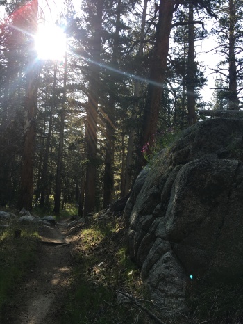
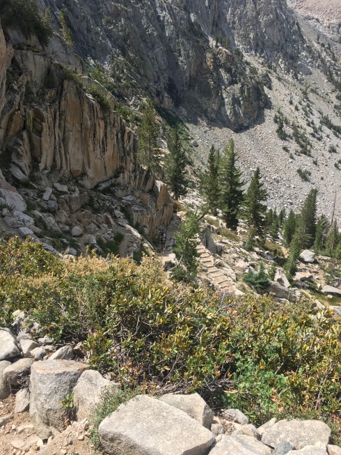
After the previous day’s smoke, we were relieved to start the day in a bright, smoke-free dawn. The trail headed due east up the Palisade Creek basin. The lower elevations were a lodgepole forest with some evidence of a ten- or twenty-year old burn. 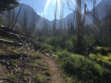 The creek’s roaring cascade along the canyon’s rocky floor filled our ears. As we worked our way up the creek, the canyon narrowed and finally we embarked on the Golden Staircase, which, like it sounds, is a long series of high stairs carved in the granite of the mountainside, and the last section of the JMT built (because the hardest), a feat of backcountry engineering. As we started heaving our topheavy selves up the steps, the aforementioned debonair group of French people began to interweave with us: one couple would pass us and stop to rest while the other couple caught up with them, at which point we’d pass the four of them only to be passed by their vanguard before long.
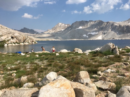
They were petite, in their sixties, jauntily dressed, and hella fast. When we finally reached the top of the staircase, we wended our way through a marmot-thick heath and collapsed on the shores of Lower Palisade Lake, where we lost no time skinny-dipping and preparing lunch (tortilla “pizzas” again). We smiled a bit smugly when the Frenchies hauled past us and set up for lunch further down the shore.
Alongside us were The Millennials: a dreadlocked, potty-mouthed, extremely outgoing woman, a towering man with a huge red beard and a carved Gandalfian walking stick, an intense dark-bearded man, and a chill dark-bearded man. Due to the potty-mouthed girl’s friendliness, we chatted and learned that they’d met up at random on the trail and had been hiking together as a group for several days, a loose alliance that, we would later see, only partially outlasted that day.
They admired our cooking ingenuity. We admired their utter freedom.
As we cleaned up after lunch, we could see the sky darkening, so we hastened to begin the hike, despite being shaky from our morning’s 2000-foot ascent. Interweaving with the Frenchies, the Red-shirted Camera crew, and The Millennials, we climbed into a straggly, scabby evergreen forest, powering towards the pass until we heard thunder and felt some rain. We passed the Red Shirt Photographer Crew setting up tents on a promontory below the trail and began to wonder if we should stop too: lightning at 11000 feet is nothing to mess around with. Soon we passed the Two Brothers from Middle Fork (the first we’d seen of them since morning), and The Millennials, all set up under the cover of the very last of the treeline.  The sky was greenly gray. A stream trickle crossed the path – not a bad place to spend the night. We met a trail crew a quarter mile out from the tree line and they urged us to turn around, so we did, setting up a makeshift camp on a peaty bench above the trail, neck and neck with The Millennials.
But then Dan and Joelle blew past all of us with a wave and a few words. We eyed the sky, dark but dry, and the pass, a bowl of thickening gray. We decided to truck on along behind them.
I went into low gear: there were still 1500 feet to gain in order to achieve the pass, and I was not going to take them fast. Soon there were no trees but bonzai-sized hemlocks. We clambered over huge piles of boulders and talus. Patches of pinpoint wildflowers cheered us on. Thunder boomed and wind whipped. On the final long slaggy climb, which lasted from 3:30 until just about 5, it finally started to rain in a way that felt serious. We stopped to take out our pack covers and then I caught sight of them: The Millennials. Potty-mouth was powering up the hill, head bent, Ginger Gandalf a few switchbacks behind her. Something took ahold of me: there was no way I was going to let her reach the pass before me. So I threw on my pack cover, and much to the Husband’s surprise, I started to haul ass. At switchback after switchback, I checked: three legs behind me, then two. I put on more speed. We tore past Joelle and Dan, who waved weakly. Though I didn’t think of it at the time, that’s when Madonna entered my spirit. I was alive and I was going for it. Flying. And then I pulled onto the pass. I’d done it, all forty-something years of me.
On the pass, we communed deliriously with The Millennials, greeting a family of four who were coming up the other side, which, they said, had been designed by civil engineers, which is to say, with cars in mind: ridiculously long, exposed switchbacks at an uncomfortable grade for human legs.
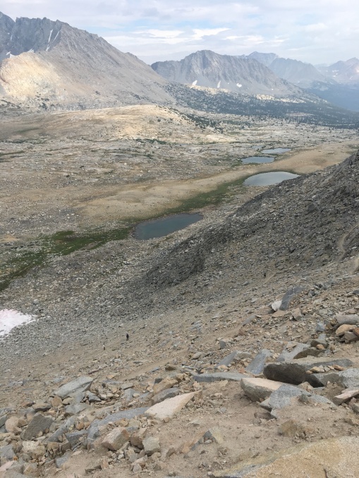
We lingered to catch one last glimpse of the wide, rocky, scraped Mars-scape we’d just traversed and turned to face the bare, sedgey, lake-dotted, and trail-scored prairie to the south.
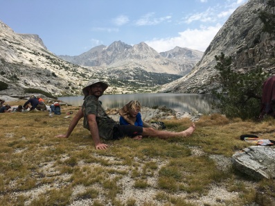
We tumbled down, bloody-stump tired, and set up camp on the edge of a pothole lake with a view of the pass. We cowed down some curry and the last of our chocolate. The Husband and Son the Elder undertook a side hike to a pothole lake in which they found strange annelids. Son the Younger and I stayed and gloried in the beauty of Mather Pass. I couldn’t resist: I belted out the soprano solo from Allegri’s Misereri Mei: G, C, B flat, A flat, G, F, G, F, E flat, F, G (wait for about 1:30). The acoustics were sick.
I imagine that my friend lost his capacity to feel joy. I can imagine that such a loss would be enough to make someone want to kill him or herself. The week after his death, I mostly lost that capacity. For some reason, driving home after teaching Thursday morning, Madonna made me feel joy. I don’t know whether I cultivated that capacity or whether it was just pure chance, a twitch of my neurons, a flare going up from my old, staunchly healthy self. Something flashed in my mind to play the song, and I did. And there I was, a week too late to help my friend, in the Southern California spring, crying and feeling, despite it all, like a goddamned ray of light.

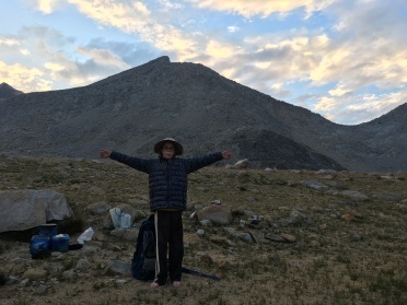
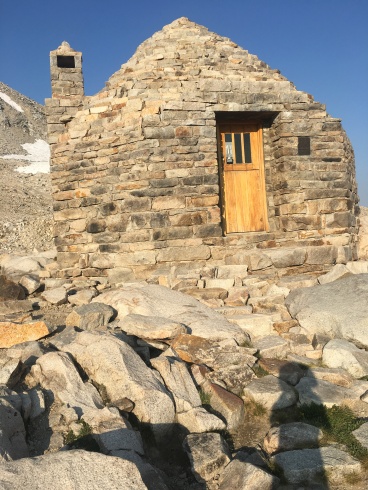 In the pass’s sun-filled saddle, a marmot greeted us, hoping to share the granola we broke out for breakfast.
 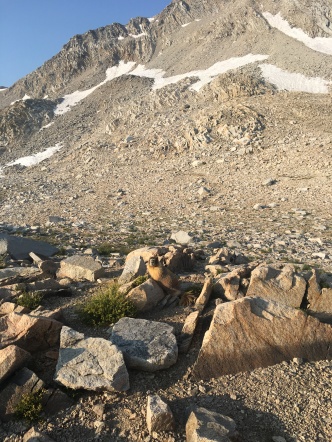 We circled the musty hut and sat inside long enough to read the plaque and its admonitions against sleeping there except in the case of extreme weather. We took pictures of the north’s dark blue, lake-dotted alpine plateau, and of the craggy east, roiling with sun-blazed morning fog.
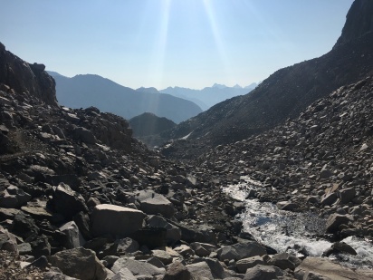 The earth’s surface shone with morning: cold sapphire and green water, brown and gold rocks, flinty precipices. The mountainside rang with light.
 The
The